
Quick answer
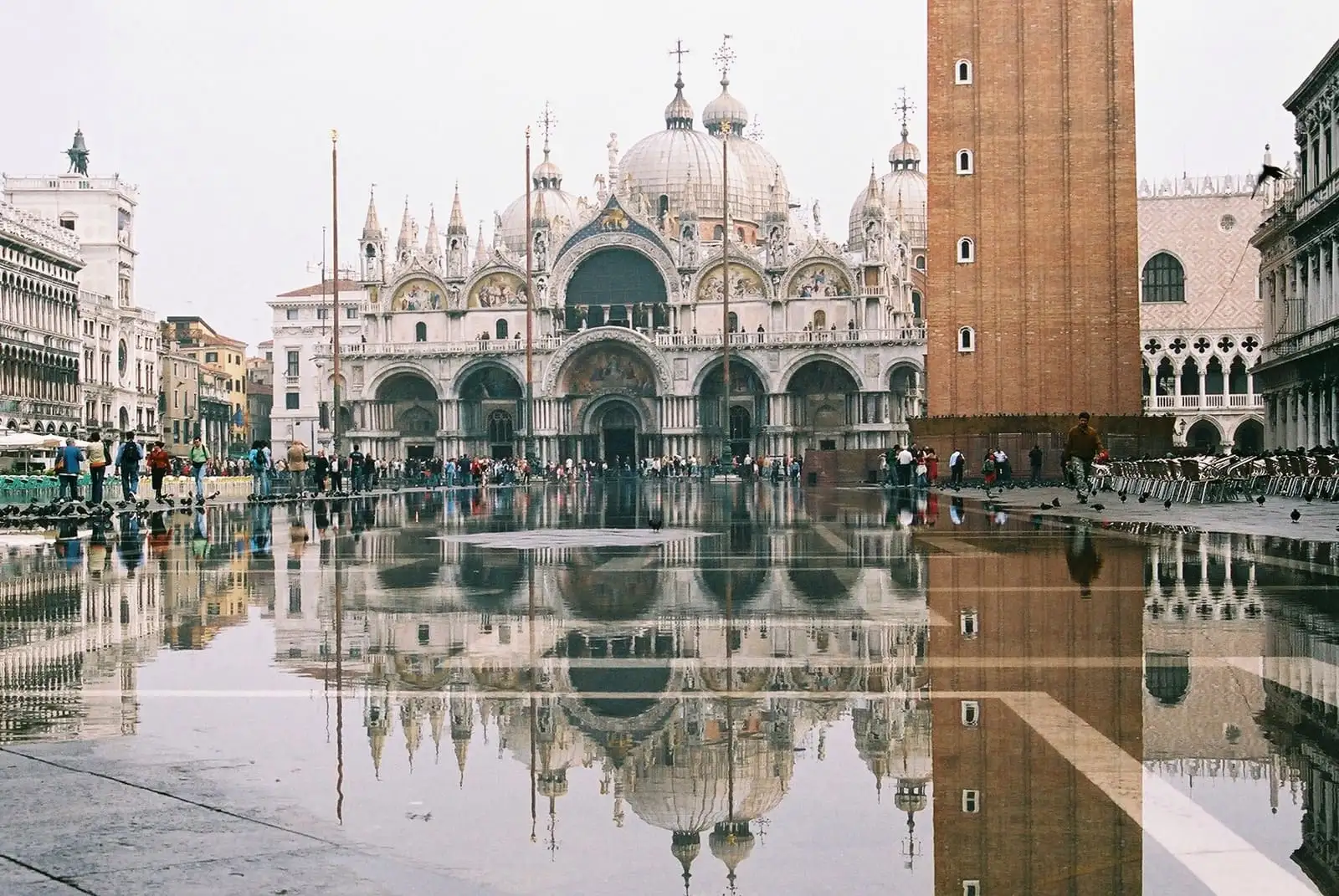
Acqua alta is a high tide pushed up by low pressure and the sirocco wind. It starts to flood St. Mark’s Square when the tide passes 80 cm, mostly in the morning between October and February, and it drains away within a few hours. Venice is also sinking, at about 1 mm a year, while the sea around it rises: together they explain why tides of 110 cm, about once a year a century ago, now come five or six times a year.
Tide data, rules and forecasts checked on 13 November 2026.
What acqua alta is
Acqua alta means “high water”. The Comune di Venezia uses the term for any tide over 80 cm, measured at Punta della Salute against a reference level set in 1897. The tide you see is the astronomical tide plus a weather surge: low pressure and a strong sirocco wind from the southeast push water up the Adriatic, and when that surge meets a high tide, the lowest parts of the city flood.
The number in the forecast is the height of the sea, so the depth of water under your feet depends on where you stand. St. Mark's SquareMap is one of the lowest points and gets wet above 80 cm, so at 110 cm its lowest stones sit under up to about 30 cm (a foot) of water. The quay by the Rialto water bus stops floods at 105 cm, and the square in front of the railway station only at 135 cm. At 110 cm about 12% of the city is under water, at 140 cm about 59%. Our Venice in winter guide has the full table of levels.
When does acqua alta happen?
In autumn and winter. The city’s tide center has counted every tide of 110 cm or more since 1872, month by month:
| Month | Tides of 110 cm or more, 1872 to 2021 |
|---|---|
| September | 2 |
| October | 45 |
| November | 107 |
| December | 80 |
| January | 28 |
| February | 35 |
| March | 11 |
| April to June | 16 |
| July and August | 0 |
About 70% of the floods fall in October, November and December. From May to August a tide that high is rare, which is why the city stops laying walkways on 1 May. The peak usually comes in the morning: in autumn the day’s highest astronomical tide falls before noon, so the water has usually gone down by the afternoon. The two highest floods on record were both in November: 194 cm on 4 November 1966 and 187 cm on 12 November 2019. If you are choosing dates, our guide to the best time to visit Venice compares the months on weather, crowds and prices too. Our month-by-month weather guide shows the tide risk next to temperatures and rain.
How long does acqua alta last?
Usually a few hours, because the tide turns. These are the average times the city’s tide center measured between 1966 and February 2026, by how high the tide peaked:
| Peak of the tide | Time above 100 cm | Time above 110 cm | How often (2006 to 2026) |
|---|---|---|---|
| 110 to 119 cm | 3 h 32 min | 1 h 22 min | Once every 2 months |
| 120 to 129 cm | 4 h 56 min | 3 h 28 min | Once every 5 months |
| 140 to 149 cm | 7 h 46 min | 6 h 46 min | Once every 1 year 8 months |
In practice the water around St. Mark’s costs you a few hours one morning. At 110 cm about 88% of the city stays dry.
Is there acqua alta now? How to check the forecast
The Comune’s tide center (Centro Previsioni e Segnalazioni Maree) publishes the forecast for today and the next two days, with the time and height of each peak, at comune.venezia.it/maree. The same forecast, with live readings from its gauges, comes through its Telegram bot @centromareevenezia_bot, and the Centro Maree Avvisa channel sends short alerts.
Before a big event the tide center meets with ISPRA and the CNR-ISMAR marine institute and posts a note on its news page. On 11 November 2026, for example, the note forecast 105 to 125 cm for 12:35am on Friday 13 November.
When a tide of 110 cm or more is on the way, sirens sound from the bell towers. After the first wail, count the tones:
| Tones after the siren | Tide expected |
|---|---|
| One long tone | 110 cm |
| Two rising tones | 120 cm |
| Three rising tones | 130 cm |
| Four rising tones | 140 cm or more |
The MOSE barriers: when they rise and what they leave
MOSE is a set of 78 mobile gates on the seabed at the three inlets between the lagoon and the Adriatic: Lido, Malamocco and Chioggia. When a high tide is coming, the gates rise and close the lagoon off from the sea. They were raised against a tide for the first time on 3 October 2020 and can hold back tides up to 3 meters.
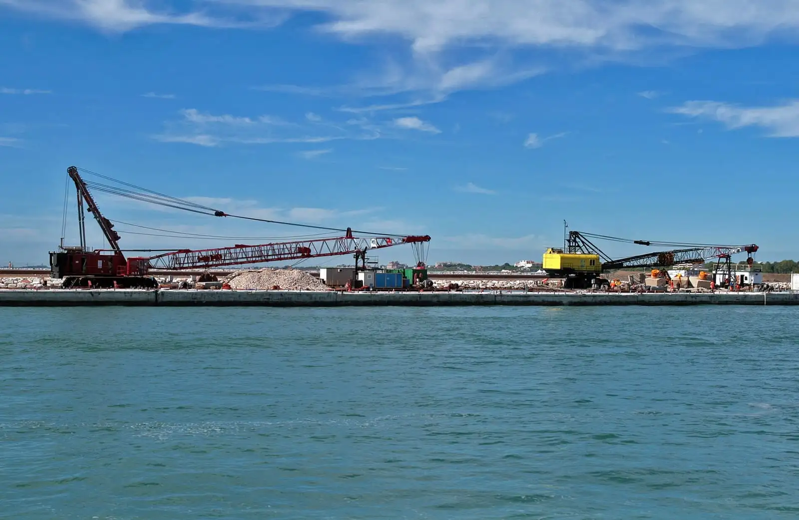
Building the MOSE barrier at the Lido inlet, seen from Punta Sabbioni in 2008.
The gates go up when the forecast is for around 110 cm, so they protect the city from the big floods. The catch for visitors: while they are up, the tide center’s own notices put the water inside at about 85 to 95 cm, and tides below the threshold come in as normal. St. Mark’s Square can still be wet on a MOSE day. The difference shows in the records: 95 tides of 110 cm or more reached the city between 2010 and 2019, and only 2 between 2020 and 2022.
What to do on an acqua alta day
On most acqua alta days the boats run and the walkways go down on the main routes, so a few habits are enough to keep your plans and your feet dry.
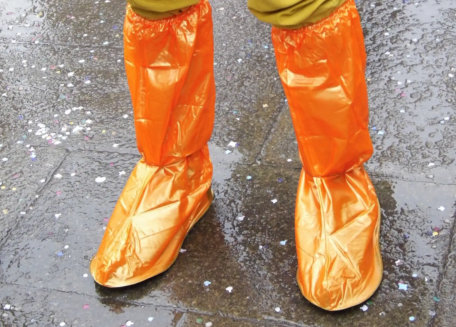
Disposable plastic overboots, sold in Venice on acqua alta days, pulled over ordinary shoes.
- Walk on the walkways. From 15 September to 30 April the city lays raised walkways (passerelle) along the main routes when a high tide is forecast. They keep your feet dry up to a tide of 120 cm. Keep to the right and let people pass.
- Take the vaporetto. Public boats run to schedule during high tides, except during the most extreme ones, though some routes change once the tide reaches 95 cm. Our vaporetto guide explains the lines and passes.
- Shift your plans by a few hours. Look at the time of the peak and put St. Mark’s after it. A museum away from San Marco, or breakfast and a slow start, fills the gap.
- Wear the right shoes. Between November and February pack waterproof boots, or buy disposable plastic overboots in the city. Treat them as a stopgap for a short walk.
If you are booking for November or December, the area matters more than the room. A hotel near the station, one of the highest points in the city, sees water far less often than one on the edge of St. Mark’s Square, and a room on an upper floor keeps you clear of a flooded ground floor. Our where to stay in Venice guide compares the neighborhoods; once you have picked one, check hotels in Venice on Booking.com.
Looking for the bookshop with the gondola full of books? Libreria Acqua AltaMap has its own page: our Libreria Acqua Alta guide.
St. Mark’s Square and the Basilica in acqua alta
The square floods first because it sits lower than most of the city. Around the Basilica the old rainwater drains run out into the basin, so at high tide the lagoon can come back up through them.
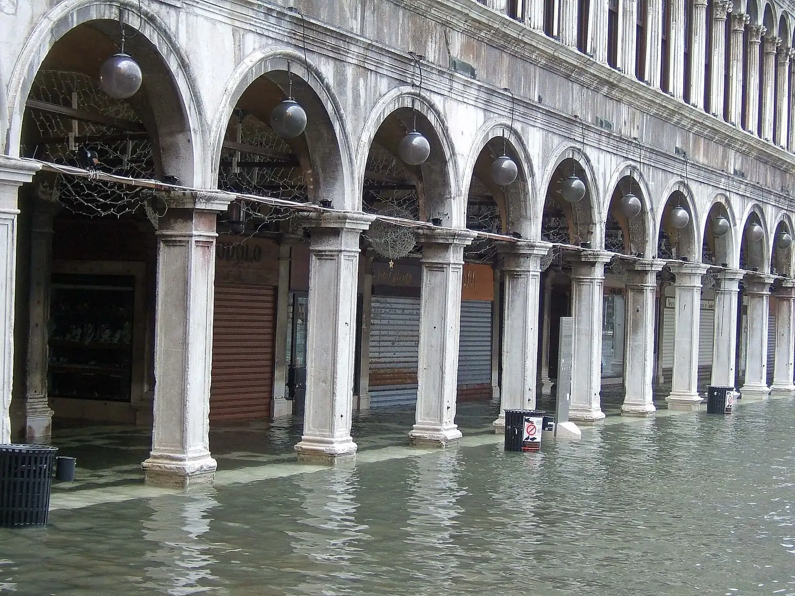


St. Mark's BasilicaMap stands at the lowest end. Before its old drains were fitted with valves and pumps in 2019, the Ministry of Infrastructure counted salt water in its atrium and on the stretch of square in front more than 200 times a year, wetting the 12th-century mosaic floor. The Basilica’s visitor rules still plan for it: if the water gets into the atrium, staff send visitors along a separate, signposted route.
If a tide is forecast, book a slot after the peak. Our St. Mark’s Basilica tickets guide has the prices and hours, and the Doge’s Palace guide covers the palace next door, which is a good plan for a wet morning.
Book St. Mark’s Basilica ticketsIs Venice sinking?
Yes, but slowly, and the rising sea now matters more. Venice stands on young lagoon sediments that keep compacting. In the 20th century people made it much worse: industry pumped groundwater from the aquifers, especially in the Marghera industrial zone on the mainland, and between 1950 and 1970 the ground in the Venice area dropped about 12 cm, the Comune’s tide center calculates. The pumping stopped decades ago. Satellite measurements by CNR-ISMAR and the University of Padova put the natural sinking today at 0.8 to 1 mm a year.
| Measure | Figure | Period |
|---|---|---|
| Ground lost to groundwater pumping | About 12 cm | 1950 to 1970 |
| Natural sinking of the city today | 0.8 to 1 mm a year | Satellite data, 1992 to 2010 |
| Sea-level rise in Venice | 9 cm, then roughly another 10 cm | Early 1900s to 1970, 1970 to today |
| Average sea level against the 1897 reference | About 32 cm higher | Average of the last 15 years |
| Relative sea-level rise (sinking plus sea) | About 2.5 mm a year, half of it from sinking | The last 150 years |
That rise is why floods are more frequent. Tides of 110 cm or more reached the city 2 times between 1900 and 1909, 31 times in the 1960s and 95 times between 2010 and 2019. Tides of 140 to 149 cm came about once every 9 years between 1966 and 2001, and once every 1 year and 8 months in the last 20 years, counting the tides MOSE has held back since 2020.
How long will Venice last?
There is no date, and the answer depends on how much the sea rises. A 2021 scientific review of sea-level rise in Venice projects a rise by 2100 of 32 to 62 cm in a low-emissions scenario, 58 to 110 cm in a high-emissions one, and about 180 cm in an unlikely worst case linked to fast ice-sheet melting. MOSE was designed to cope with a sea-level rise of up to 60 cm over 100 years, so the higher scenarios go beyond its margin.
For a visit in the next few years the picture is simpler: the big floods are held back by MOSE, the smaller ones still wet St. Mark’s on some autumn and winter mornings, and a summer trip almost never meets acqua alta. If you are still planning the trip, our guide to how many days in Venice has 1, 2 and 3 day plans.
Frequently asked questions
What time of year is acqua alta in Venice?
From October to February, with November the peak month. Of the 324 tides of 110 cm or more recorded in Venice from 1872 to 2021, 107 came in November, 80 in December and 45 in October. There were none in July or August.
Does Venice have acqua alta now?
Check the tide forecast of the Comune di Venezia on the day. It covers today and the next two days with the time of each peak, and its Telegram bot @centromareevenezia_bot gives the same forecast and live levels.
How long does acqua alta last in Venice?
A few hours around high tide. When the peak is between 110 and 119 cm, the city's tide center measures an average of 1 hour 22 minutes above 110 cm and about three and a half hours above 100 cm.
Is Venice really sinking?
Yes, slowly. Satellite measurements put the natural sinking of the city at 0.8 to 1 mm a year, and the sea is rising too. Today the average sea level in Venice is about 32 cm higher than in 1897, the city's reference year.
How long will Venice last?
Nobody can give a date. A 2021 scientific review expects the sea in Venice to rise 32 to 62 cm by 2100 if emissions are cut, and 58 to 110 cm if they are not. The MOSE gates were designed for a rise of up to 60 cm over 100 years.
Can they fix Venice sinking?
The worst cause has already been stopped. Groundwater pumping for industry lowered the ground by about 12 cm between 1950 and 1970 and ended decades ago. Rising seas are now the bigger problem, and the MOSE gates hold back the highest tides.
Why can't you swim in the canals in Venice?
It is banned. The Comune di Venezia fines anyone who bathes, dives or swims in the canals €350 and can also ban them from the area on the spot.